
ARCH 202A
PART 1 & 2 | CONTEXT AND SCENARIO
Altadena Post-Fire Urban Reconstruction & Contextual Mapping
October 2025
Part II of the semester expanded our work from Part I into a collective urban design scenario for post-fire Altadena, developed in collaboration with George Ye and Victor Solorzano. The assignment asked us to propose possible futures for the Lake Avenue corridor through research-driven strategies addressing environmental resilience, public space, and civic life. Rather than proposing a singular formal solution, we emphasized systems, relationships, and long-term adaptability. Building on our earlier site analysis and research, my contribution reframed Altadena through an environmental lens taken to its extreme, using landscape, water, and ecological systems as the primary drivers of urban form.


The proposal reintroduced historic waterways descending from the San Gabriel Mountains into a re-established wetland system, reshaped into a circular form that disrupts Altadena’s pre-existing rigid grid. This circular landscape becomes both a spatial and ecological organizer, guiding circulation, density, and public life. Debris flow from the burn scar is repurposed to generate new topography around the wetland, allowing the post-fire landscape to actively shape the city rather than be erased by it.
Infastructure is embedded within this reconstructed landscape, elevated and carefully positioned among existing oak trees that survived the fires. These trees became evidence that architecture could coexist with, and learn from natural systems rather than replace them. Questioning whether a city designed around ecological continuity could foster a deeper connection between humans and their environment, asking how architecture might operate as an extension of natural processes rather than an imposition upon them.
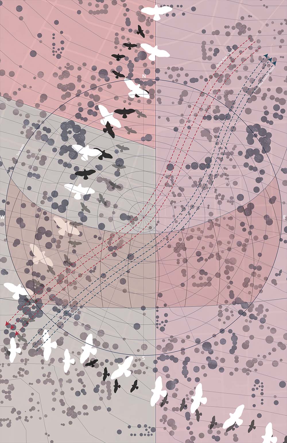

Environment diagram
Synthesizing climatic, ecological, and risk-based conditions shaping Altadena’s post-fire landscape, the diagram maps solar orientation, prevailing winds, vegetation density, fire risk, topography, and wildlife movement patterns to reveal how environmental forces operate across the site beyond parcel boundaries.
Rather than treating environmental factors as static constraints, the diagram frames them as active systems, forces that shape inhabitation, movement, and resilience. Bird migration paths, tree canopies, and areas of ecological density are layered alongside zones of heightened fire risk and exposure, illustrating how natural systems persist and adapt even within a damaged urban fabric. This analysis became foundational for later design work that prioritized coexistence between architecture, wildlife, and landscape.
Mobility diagram
Examining movement across the district at multiple scales, from pedestrian circulation to regional connectivity, the diagram maps street hierarchies, pedestrian paths, walking radii, and alternative modes of movement to challenge the dominance of vehicular infrastructure in Altadena pre-fire.
By emphasizing 5-minute and 15-minute walking distances, we reframe accessibility through human and non-human movement, highlighting how people, animals, and ecological corridors intersect across the site. Trails and circulation routes are read not only as paths of efficiency, but as spatial opportunities for encounter, slowness, and shared use. This analysis informed later proposals for a car-reduced environment that prioritizes walking, wildlife passage, and community-scale connectivity.

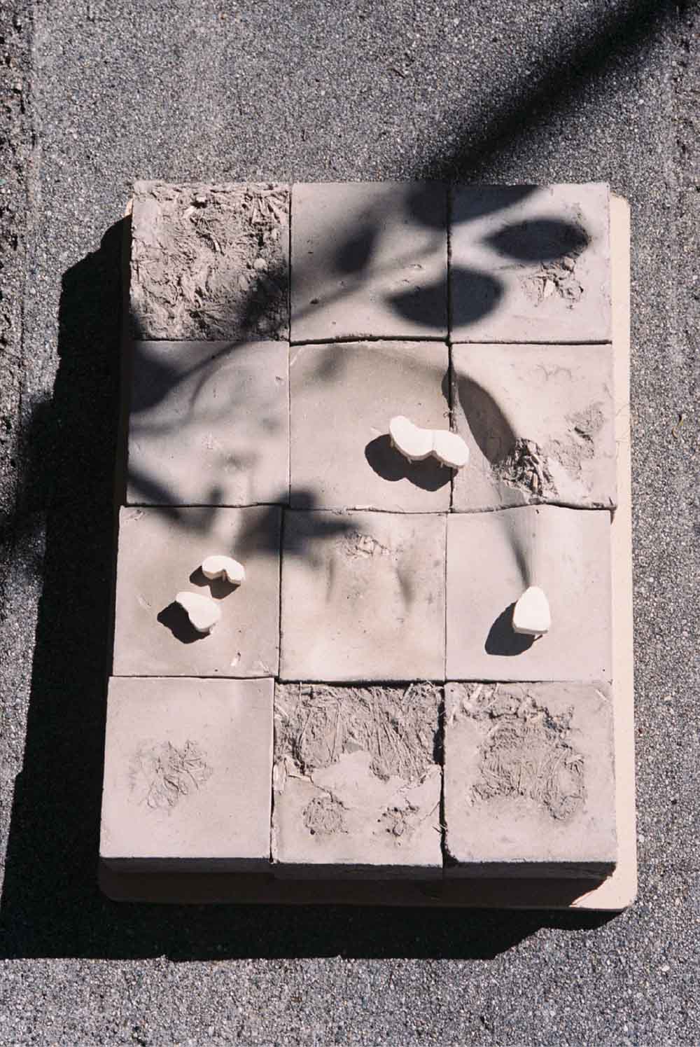

Concrete site model - George Ye
By reintroducing water, landscape, and ecological systems as the foundation of urban form, we propose an alternative future for Altadena, one where architecture supports regeneration rather than recovery alone. The project ultimately asks whether cities designed in this way can foster stronger relationships between people, wildlife, and place, positioning environmental systems not at the periphery of urban life, but at its core.
Part I focused on contextual research and diagrammatic analysis of Altadena following the Eaton Fire, using mapping as a tool to reveal existing systems and constraints. Working collaboratively with George Ye and Victor Solorzano, our group produced a series of layered diagrams to understand the district’s spatial, environmental, and infrastructural conditions. I designed the environment and mobility diagrams, analyzing factors such as topography, fire risk, vegetation, wildlife patterns, and climatic forces alongside pedestrian networks, walking radii, and circulation corridors. These diagrams established a shared graphic language and analytical framework, grounding later design speculation in the environmental and urban realities of the site.

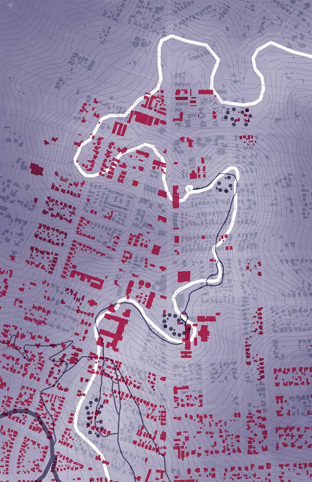
Land Use - George Ye
Seasonal change is fundamental to the spatial experience. During winter months, rising water levels bring the wetland to its fullest extent, while drier seasons gradually reveal more of the landscape below. This continual transformation is explored through sectional drawings, emphasizing how architecture and public space adapt over time. By making environmental fluctuation visible, this reframes instability not as a problem to be controlled, but as a condition to be understood and inhabited.
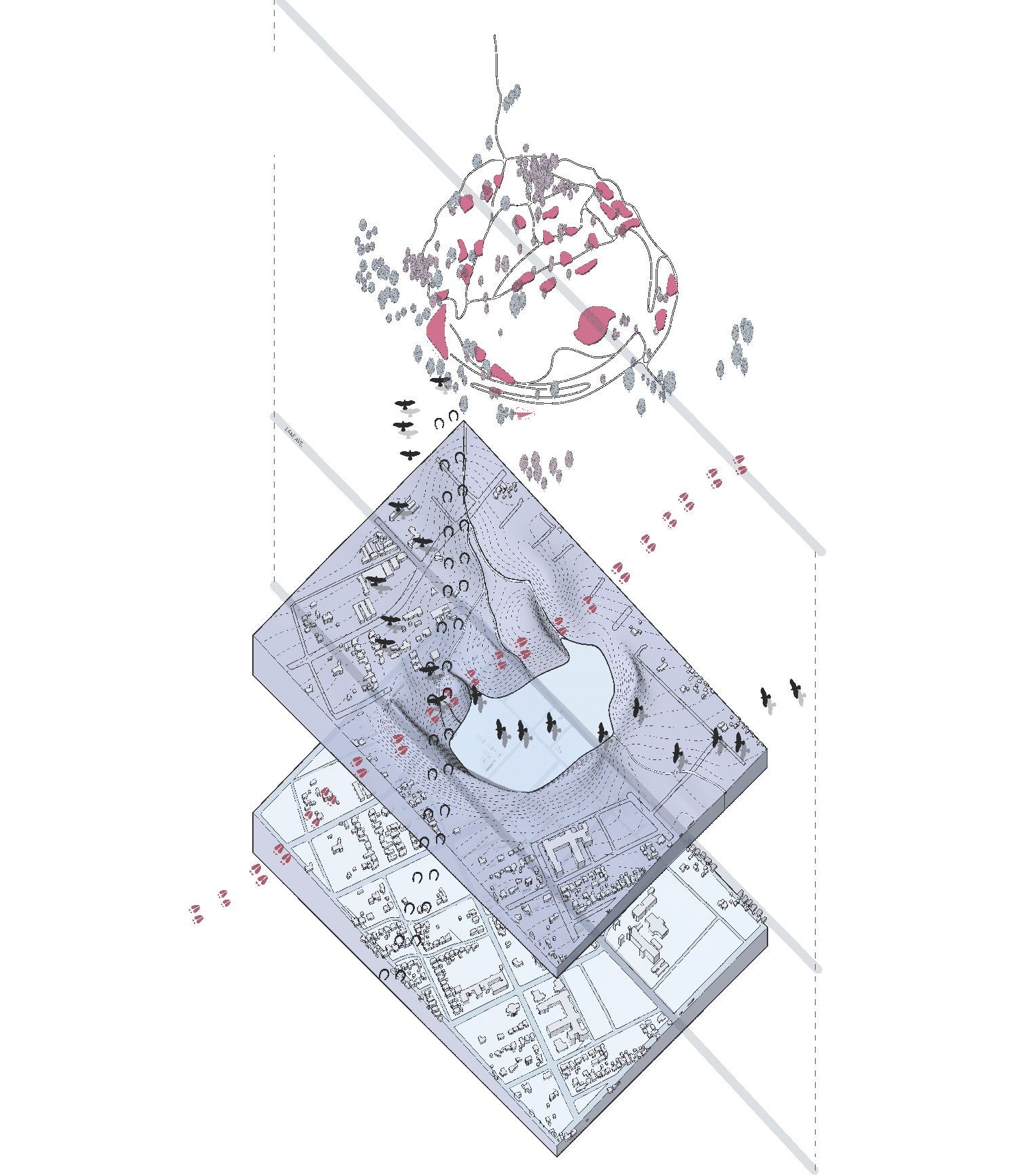
Axonometric - Victor Solorzano
Circulation throughout the proposal prioritizes walking while allowing wildlife to pass uninterrupted through the site. Primary trails are designed for both human movement and animal migration, accommodating deer, horses, coyotes, and smaller species. These paths weave through the topography and built fabric, reinforcing the idea of a shared territory where human activity does not dominate but participates within a broader ecological network. The wetland itself is designed to invite bird habitation, using water, planting, and topography to create layered habitats.

Form and Demographics - Victor Solorzano